
Uihlein Foundation's Heaven Hill & Henry’s Woods Trailhead Maps & Kiosks
Updated Trail Maps, Kiosk Design, and Connected Digital Mapping for Lake Placid Trails
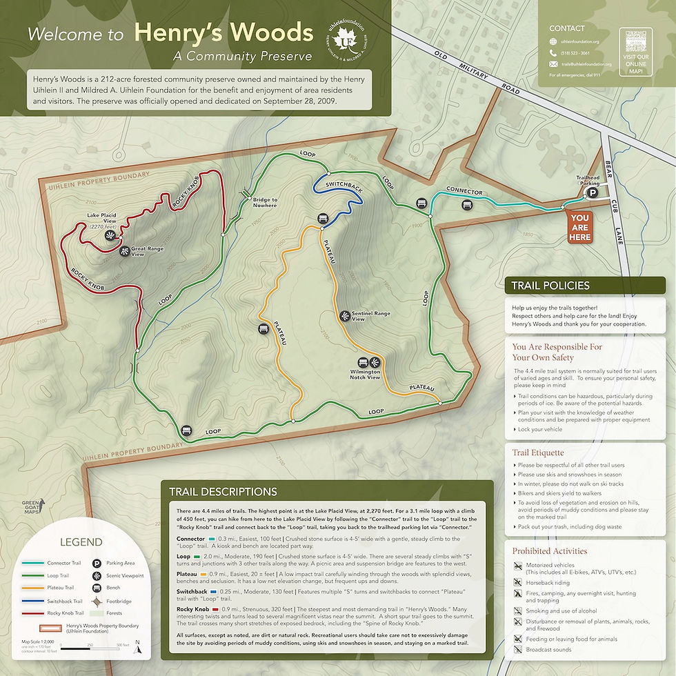
The Uihlein Foundation stewards Heaven Hill Trails and Henry’s Woods, two trail systems in Lake Placid, New York. The Foundation wanted to update its existing trailhead kiosks with more current maps and branding while making it easier for visitors to find trail information both at the trailhead and online.
Green Goat Maps designed the kiosk panels for both properties, including updated custom trail maps, using the Uihlein Foundation branding, and placing QR codes connecting visitors to the online maps by Green Goat Maps. We worked within the dimensions and structure of the existing kiosks, allowing the Foundation to modernize the visitor experience without replacing the trailhead infrastructure already in place.
The project also extended beyond the two main kiosks. We designed smaller signs for Heaven Hill and Uihlein Farm to communicate trail rules, seasonal access restrictions, and the importance of protecting sensitive grassland bird habitat. These signs use concise messaging and QR codes to provide additional information without overwhelming visitors at the trail.

To connect all of these materials, Green Goat Maps also developed an interactive online map featuring the Uihlein Foundation properties and detailed trail information for Heaven Hill and Henry’s Woods. QR codes on the physical signage connect visitors directly with the digital map, creating a coordinated system that can continue to provide current information even as conditions and trail information change.
Need to Update an Existing Trailhead Kiosk?
A new visitor experience doesn’t always require starting from scratch. Green Goat Maps can redesign existing kiosk panels, update outdated trail maps, and connect physical signage with interactive online maps while working within your current structures and branding.
For organizations managing multiple trail systems or preserves, we can also develop a consistent mapping and signage approach that makes each property easier to navigate while tying the entire network together.


Comments